

Blog & Research Notes
Technical essays and research notes on geographic science, GIS analytics, geomorphological fieldwork, and spatial engineering.
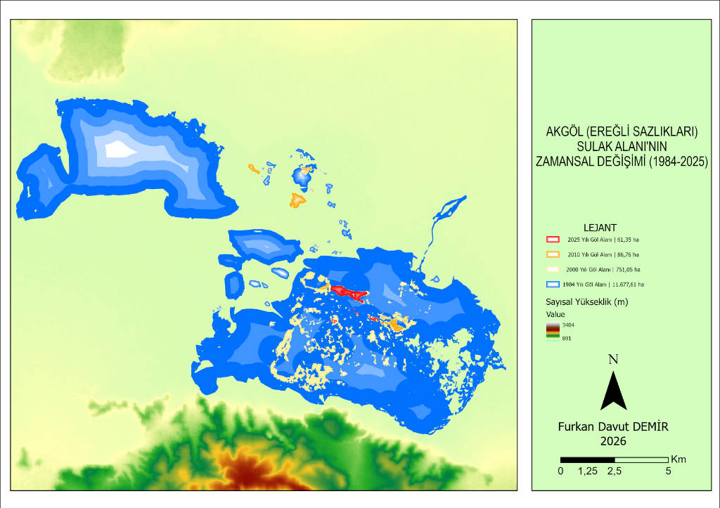
Spatial Change in Akgöl Wetland: The Role of Climatic Factors and Anthropogenic Pressures
Multi-temporal satellite observation (1984–2025) of the wetland desiccation in the Konya Closed Basin. Processing Landsat & Sentinel-2 archives on Google Earth Engine using MNDWI and dynamic Otsu thresholding.
New Articles Coming Soon
In-depth technical analyses, case studies, and research notes spanning physical and human geography, GIS methodologies, satellite remote sensing, and spatial software engineering will be published here soon.
Topics in Preparation
Topics with compiled field notes and data analyses currently being prepared for publication:
PostGIS in Spatial Databases: Modeling Geographic Vector Data at Scale
Engineering guide on R-Tree spatial indexing, ST_DWithin performance, and topological integrity rules to query millions of point and polygon features in milliseconds.
Speleological Fieldwork Techniques for Cave Systems in Karst Geomorphology
Geomorphological mapping principles during field investigations of lithological limestone discontinuities, tectonic fracture lines, and speleothem formations.
Architecture of Geographica: How a 1,000+ Term Offline Dictionary Was Built
The development story behind Geographica on Google Play: offline-first data architecture, Android UI/UX principles, and compiling a bilingual geographical terminology database.
Have a Topic Suggestion or Inquiry?
If you have a specific GIS methodology, satellite imagery pipeline, or spatial modeling topic you would like me to cover, feel free to reach out directly.